
Walk a Racine Street Record
A sound street-by-street search separates ownership from occupancy. Begin with the address as printed, including any direction, street type, unit, municipality, and ZIP. The City of Racine Assessor supplies municipal ownership, legal-description, sales, building, and assessment facts. The county parcel layer then adds a durable Parcel Identification Number, or PIN, plus mapped geometry. Those names are owners in a property system, not a complete list of residents.
- Normalize the house number, direction, full street type, unit, municipality, and ZIP before searching.
- Match the address in the city assessor and county parcel layer. Save the full PIN, site address, map shape, and update date.
- Use the county tax inquiry to check the parcel key and tax history, then distinguish the site address from the owner mailing address.
- Follow recorded parties through the Register of Deeds index. Move backward from the current instrument when older ownership matters.
- Check MyVote only for a properly authorized current voter query, then use library criss-cross material for a date-bounded historical address.
The chain works because each source answers a smaller question. Parcel data identifies land. A deed identifies parties to a recorded transfer. MyVote confirms a matching registration when required fields agree. A city directory associates a listed person or business with an edition and address. None should be stretched into proof of a full household.
Query Racine Streets by Parcel
The Racine County TaxParcelQuery layer is unusually useful for address research because it exposes both map geometry and address attributes. It supports attribute queries, spatial-distance searches, pagination, and common data formats. A 1,000-record limit applies per response, so a broad street export may need pages. Retain the layer's Last Update Date with any result.
| Search clue | Official field | Use in a street search |
|---|---|---|
| Physical location | Site Address, Building Number, Unit Number | Matches the building or unit to the mapped parcel. |
| Parcel key | Parcel Identification Number, PIN12 | Connects maps, taxes, and later deed work. |
| Indexed owners | First Owner Name, Second Owner Name | Shows property-record names, not all occupants. |
| Tax mailing | Postal Address, City, State, ZIP 5, ZIP+4 | Shows where tax mail goes, which may differ from the site. |
| Map context | Shape, zoning, tax district, subdivision | Places adjacent lots and legal areas along the street. |
The official layer's visible fields are shown in this Racine County parcel-service view.
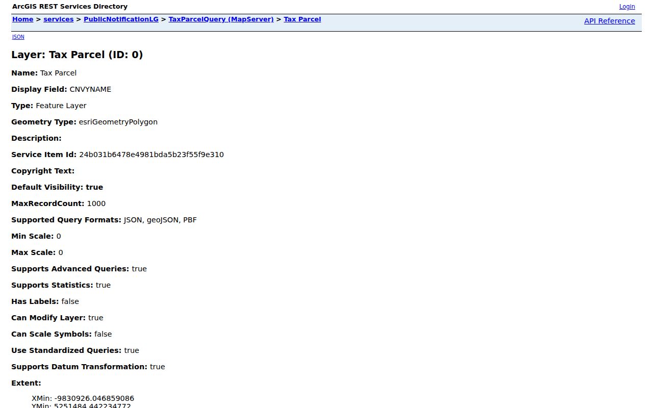
The service screen is a field catalog and query endpoint, not a certified deed. It makes the difference between site and postal addresses visible before any owner name is treated as a resident clue.
Note: A blank owner or building field is not proof that the parcel or structure does not exist.
Racine Street Directory Sources
Racine address sources overlap without becoming interchangeable. The assessor updates municipal property data daily. County Ascent accepts an address, owner name, or the last twelve digits of the tax key. LandShark covers indexed real-estate documents from 1989 forward, while older instruments move to office terminals, deed books, microfilm, and written requests. Permits and code cases can date work at an address, but they do not form a resident roll.
| Address record | Custodian | What it can establish | Access channel |
|---|---|---|---|
| Assessment roll | City Assessor | Owner field, legal description, structure, sales, assessment | Online search; City Hall contact |
| Parcel and tax data | Racine County | PIN, site and postal address, map, tax history | GIS layer; Ascent; county map resources |
| Recorded instruments | Register of Deeds | Recorded parties, document type, date, legal tract | LandShark; public computer; microfilm; request |
| Registration match | Wisconsin Elections Commission | A matching current voter registration | MyVote form; municipal clerk fallback |
| Permits and code events | City Building Inspection | Project or enforcement event tied to an address | Forms; Tolemi map; focused records request |
The Racine assessor landing page is the city doorway to the property search, tax lookup, and assessment roll.
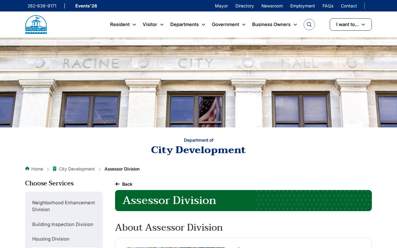
Use the displayed roll date when saving a result. A later transfer, correction, or assessment update can change what appears.
Read Racine Address Terms
Small labels prevent large mistakes. Record these terms exactly when moving among Racine city and county systems.
- Parcel
- A mapped unit of land with its own identifying number; it is not the same as a household.
- Situs address
- The physical site address of the parcel, unlike the postal address used for tax mail.
- Plat
- A recorded drawing that divides land into lots, blocks, streets, or other units.
- Criss-cross directory
- A directory arranged by street and house number, useful when the address is known but the historical name is not.
Multi-unit buildings, condominium units, parcel splits, mergers, corner lots, alleys, and rights-of-way can break a simple one-address-to-one-parcel assumption. Save the geometry and legal description when an address search produces more than one plausible result.
Separate Racine Street Addresses
County GIS stores a Site Address and a separate Postal Address. The first places the parcel. The second tells where tax or owner mail is sent. A postal city or ZIP outside Racine can be valid, and it does not prove that the owner lives away from or at the property. This distinction is one of the most useful checks when researching by address.
The county tax inquiry also has a local key quirk. It asks for the last twelve digits of the fifteen-digit Parcel ID with dashes removed. The county explains that the first three digits identify the municipality, so stripping the prefix for a tax-key query should never mean discarding the full PIN from research notes.
Note: Keep the full PIN in your worksheet even when a portal asks for only its last twelve digits.
Follow Racine Streets Into Deeds
The Racine County Register of Deeds turns a parcel match into an ownership trail. LandShark has free index searching for 1989-present real-estate documents. Images cost $2 for the first page and $1 for each added page. Search by grantor or grantee, meaning the party transferring an interest and the party receiving it, or use the tract and legal-description index. Record the document number, parties, document type, recording date, and prior instrument before moving back another step.
LandShark is only one channel. The courthouse provides a public computer, and older deed books or microfilm may be needed before the online cutoff. The office does not perform title searches by phone. A narrow written request should give the address, PIN, record type, and date range. For ownership conclusions with legal weight, use a title professional rather than a casual street search.
Racine Street Names Need Context
A 1975 SEWRPC addressing report counted at least 105 duplicated names and 292 duplicate streets across Racine County. It described thirteen separate numbering systems and repeated names such as Main, State, Washington, and Wisconsin. Roads can also change names at municipal lines. A bare street name is therefore unsafe; municipality, ZIP, cross street, and historical spelling belong in the query.
The report proposed a countywide baseline in the City of Racine and described quadrant ranges, but no official source confirmed that every proposal became current practice. Treat the report as numbering history, not a present-day rule. For old addresses, the four-sheet 1858 map and the twenty-seven-sheet 1887 Sanborn set can reconnect a directory entry to lots, blocks, buildings, and wards.
Check Racine Address Events
Racine Building Inspection publishes permit forms for many kinds of work, yet the research did not locate a complete official address-level permit archive. A focused request should name the address, permit type, and date span. The Tolemi public property map, launched by the city in 2023, presents active and prior code violations by property address.
A permit may name an owner, contractor, or contact for one project. A code entry documents an administrative event. Neither proves residence. They work best as dates in a property chronology, checked against assessor facts, deed dates, historical maps, and the edition date in the Racine directory book collection.
Use Racine Voter Address Fields
MyVote Wisconsin asks for Street Address, City, and ZIP; Unit is used when needed. Enter the full street type and direction, put only the unit in its field, and use the correct mailing city. A successful match concerns a current registration submitted with the required facts. It does not provide a browsable list of every voter along a Racine street.
If the form fails, correct spacing, punctuation, city, and unit first, then contact the municipal clerk or Wisconsin Elections Commission. Badger Voters offers paid CSV requests with jurisdiction filters, not a simple public block browser. Protected participants, including people using Wisconsin Safe at Home, may have substitute or confidential address treatment.
When Racine Street Portals Stop
Online gaps change the access route. County GIS and Public Works can help route map or data questions at 14200 Washington Avenue in Sturtevant, by phone at 262-886-8440, or at rcpublicworks@racinecounty.gov. Listed hours are 7:00 a.m. to noon and 12:30 to 4:30 p.m. The city assessor works from City Hall Room 308 at 262-636-9119 and assessor.office@cityofracine.org.
For older addresses, Racine Public Library provides reference city directories, staff-pulled microfilm, nearby-listing help by phone, newspapers, and a History Room by appointment. Recorded instruments may require the Register of Deeds public terminal, older books, microfilm, or a focused request. Under the Wisconsin Public Records Law, Wis. Stat. §§19.31-19.39, direct the request to the office that keeps the specific record and give a usable date range.
Limits of Racine Street Directories
A street directory assembles record-specific clues, not a complete household list. Parcel owners may live elsewhere. A voter form confirms only a matching registration. A deed records a transaction. Directory entries are tied to one edition, and a code or permit file reflects one event. Names may also be redacted, substituted, confidential, outdated, or absent.
Lawful use. Use Racine address records only for lawful personal research. Never use a name, map, or address to stalk, harass, threaten, or harm anyone.
Date each source, keep its custodian, and verify important conclusions with the office record. A result that agrees across independently kept sources is stronger, but it still should be stated in the limited terms those records support.