
Racine Previous Residents by Era
Each source answers a different part of the question, "who lived here before?" Racine County deeds identify parties to recorded transfers, while assessor and tax data anchor the modern parcel. A directory can place a listed occupant at an address for one edition. Newspapers, permits, historic maps, and property files then help explain changes between those dated points. None of these records alone is a complete list of previous residents. The strongest address history comes from sources that agree on the name, place, and time.
| Racine source | Documented span | Where to use it | What it can establish |
|---|---|---|---|
| LandShark deed index and images | 1989 to present | Racine County LandShark or the Register of Deeds public computer | Grantors, grantees, instrument details, and legal descriptions |
| City directories and criss-cross volumes | Holdings reach 1858; microfilm run 1882 to 1960 | Racine Public Library | Dated address listings and, in some volumes, nearby entries |
| Racine newspapers | 1838 to present on microfilm | Library newspaper resources | Obituaries, notices, sales, and address-linked events |
| Historic maps | 1858 landowner map; January 1887 Sanborn set | Wisconsin Historical Society and Library of Congress | Lots, blocks, owners, buildings, wards, and building footprints |
| Assessor, parcel, and permit records | Current coverage; older permit span not documented | City assessor, county GIS, and City Building Inspection | Current parcel key, structure facts, and dated work on a building |
Begin with the newest reliable record and move backward. For a recent transfer, use the current parcel and LandShark index. For an address before the online cutoff, ask the Register of Deeds about deed books, microfilm, or a focused copy request. A nineteenth- or early twentieth-century question often starts at the library or state historical collection, then returns to the deed office once the older legal description is known.
Fix the Racine Address First
An old house number is not always a safe search key. The Racine County tax-parcel layer separates the site address from the owner's postal address and supplies the full parcel identification number, PIN12, property description, subdivision or condominium name, and map geometry. Record the municipality too. The same street label can appear in more than one place, and a corner parcel may face a different street than an older directory used.
Copy the legal or property description exactly. Lot and block language may survive a street-name or number change and can connect a modern parcel to a deed or map. The 1975 county addressing study found widespread duplicate street names, so a bare street name is weak evidence. If the current parcel was split, merged, or converted to condominium units, keep every old and new parcel key found in the chain.
Note: A postal address is used for mail; a site address locates the parcel and may be the better historic search key.
Racine Deeds Cross a Cutoff
LandShark's public computer tract index and real-estate images cover 1989 to the present. Index searching is free. Images cost $2 for the first page and $1 for each added page, and occasional card users need an account and pay the stated convenience charge. The online date is an access boundary, not the start of Racine land ownership. Earlier deed-book and microfilm coverage was not pinned down in the official sources, so no guessed start year belongs in an address history.
The Racine County Register of Deeds offers a first-come public computer from 8:30 a.m. to 4:00 p.m. Staff do not perform a title search for visitors or by phone. A mail or email copy request should identify the record type, time span, parcel ID or street address. For formal title work, the office recommends a title professional.
Walk Racine's Deed Chain Back
A deed chain follows recorded transfers from the present parcel toward earlier owners. First confirm the current PIN and legal description through the City of Racine Assessor and county parcel sources. Then use the recorded-document index, preserving the document number, parties, type, date, and tract detail at every turn. An owner name on a tax card does not prove that the person occupied the building, but it provides a useful starting point.
- Copy the current owner field, full PIN, site address, and legal description from the dated parcel record.
- Find the deed that conveyed the property to that owner. Save its recording details and open the image when needed.
- Take the seller, or grantor, and search that person as an earlier grantee. Match the tract and legal description, not merely the surname.
- Repeat the transfer link until the chain reaches the 1989 online boundary or a parcel change breaks the match.
- Use the courthouse computer, a focused office request, deed books, microfilm, maps, and directories for the earlier trail.
- Grantor and grantee
- The grantor transfers an interest; the grantee receives it.
- Chain of title
- The linked sequence of recorded transfers for the same property interest.
- Legal description
- The land description in the instrument, often using lot, block, subdivision, or metes and bounds rather than a mailing address.
- Criss-cross directory
- A directory arranged by street or address, useful when the occupant's name is not yet known.
Maps Place Racine Past Residents
The 1858 Racine map has four sheets showing lots, blocks, landowners, buildings, wards, churches, schools, the press, and hotels. It helps translate an early directory or deed reference into physical geography. The January 1887 Sanborn fire-insurance map has 27 sheets. Record the sheet and exact block because those maps describe building footprints and fire risk, not today's use.
These numbers reveal why prior-resident research spans more than one portal. The modern deed index begins in 1989, yet Racine maps and directories reach deep into the nineteenth century. A map may show an owner or building when a directory supplies a listed occupant. Pairing them can strengthen a claim, but one should not be made to say what only the other records.
Racine Property Files Show Method
Wisconsin Historical Society property files give two concrete Racine examples. The HI230039 file combines directory evidence from 1960 through 1964, a construction-date clue, and an obituary. The 1224 Jefferson Street file links a permit issued on April 22, 1952 with directory entries from 1952 through 1960. These are models for building an evidence table, not current occupant searches.
A simple table should list the date, source, exact address form, person or business named, page or instrument number, and what the record actually proves. Permits may identify an applicant or owner connected to work, but not every household member. Historic-property records can also survive when a searchable city permit index does not. Contact City Building Inspection or use a narrow public-record request for files that are not online.
Library Routes to Past Residents
The Racine Public Library holds reference directories dating back to 1858. The second-floor reference copy is listed at call number 917.75 R11, while directory microfilm covers 1882 through 1960. History Room items do not circulate, and the room is available by appointment. Microfilm is pulled by staff; readers, scanning, and printing are available under library rules. Directory and criss-cross information, including nearby listings, may also be requested by phone within the library's stated service limits.
Remote choices include BadgerLink, HeritageQuest, Chronicling America, and FamilySearch. Ancestry Library Edition requires use at the library on its terminals or Wi-Fi. The 2025 digitization project includes maps, yearbooks, city directories, church histories, and other local records, but the project does not mean every item is already online. When an edition is absent, ask library staff or the Racine Heritage Museum about an appointment or reproduction rather than assuming a gap in residency.
The Racine Heritage Museum's Omeka collection offers a public view of its searchable digital material.
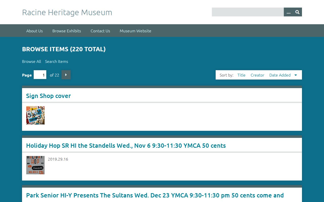
The pictured interface supports keyword, exact, item, file, and collection filtering, while the museum's broader archive still requires its finding aid and direct research contact.
Racine Households Beyond Ownership
Previous residents include people who never appeared as owners. A city directory may list a person, spouse notation, work, or business connection, depending on the edition. A reverse or criss-cross section can turn the address into names. Record the year, edition, page, complete name, and exact address. Then check the nearby years. The full shelf and access details belong on the Racine city directory page, while the address timeline should keep only the entries tied to this parcel.
Pair directory dates with available census material, then test gaps against newspapers, obituaries, permits, and burial records. Racine newspaper microfilm reaches 1838 to the present. A known death date can make an obituary check far more precise. Cemetery or probate material may close a trail after a person left the address, but it should not be read as proof of residence on an unstated date.
- Log the listed household in one directory edition, including its page and address form.
- Check the editions before and after it to narrow the arrival or departure interval.
- Compare a nearby census year and note each household member the schedule actually places there.
- Use newspapers, obituaries, permits, and deeds to explain changes without filling gaps by guesswork.
Lawful use. Research previous residents for house history, genealogy, or other lawful personal purposes. Never use an address trail to track, threaten, or harass a living person.
Safe at Home can substitute a protected address in public systems. Respect that boundary. A no-result or substitute address is not evidence that a person never lived in Racine, and it is not an invitation to seek the confidential location elsewhere.